Building the TalkData network for RAMM using ArcGIS Pro and open source data
Upcoming TalkData content is going to be getting hands on and practical with data. To help make this happen I wanted to have a 'data sandbox' to use here on this blog. The purpose of the sandbox would be to demonstrate different processes, tips and tricks for use on your own data.
So I set about creating a custom TalkData network in RAMM - a fictional transport network based in real-world environments.
This post talks through the process and tools applied in the process.
Site selection
First; selecting some random locations to add to the network. Sites around Auckland were the go-to pick, being the home city of The Datastack. There are also some travel time advantages for upcoming planned posts (hint ... it may involve some spatial data collection).

For the initial network dataset, the following small areas were chosen;
some rural-like roads near Stanmore Bay
an urban residential area on the North Shore
a downtown area in Auckland CBD
an industrial area in East Tamaki
There will be more locations added in the future. And it wont be necessarily limited to Auckland. If you want to see your local area featured in a future TalkData post, then get in touch to suggest an area.
Designing the workflow
I needed to have a workflow in place to source some basic centrelines. With that base centreline framework in place, some light authoring / modification would also be needed to make the data RAMM compatible.
ArcGIS Pro is my go to tool for network centreline projects. I have used this for previous client projects such as creating / improving centreline alignments for specific roads, digitising whole areas of networks from CAD drawings and aerial photography, and undertaking centreline data validation type activities.
The general workflow needed for this particular task is outlined below below.

There are multiple ways to get centrelines into RAMM. This is represented by two of these options being shown above; the use of shapefiles or creating a bulk export of the geometry using Python.
Sourcing the centrelines
Next up; some centrelines were needed for the network. To leverage some good open source data, the LINZ NZ Roads Dataset was chosen as the starting point.
At this point it's worth noting a limitation of the LINZ dataset in this particular type of use case. The centrelines in this dataset do not "represent actual road formation". That would obviously be an important consideration to factor in if you are working in a production environment for a roading network. For use in this blog though, it is absolutley going to be fit for purpose for our needs.
This could also perhaps be an opportunity as well.... a future post on using RAMM Centreline Manager to improve centreline accuracy?
Creating the dataset in ArcGIS Pro
Next step; a RAMM friendly network definition was created in ArcGIS Pro. This included using the LINZ dataset as the base geometry for the network.
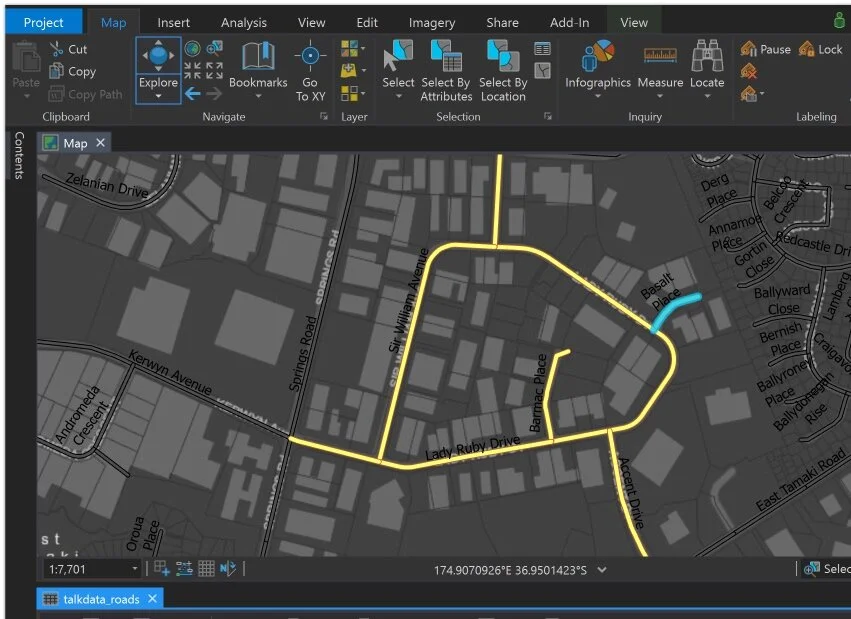
Other network attributes were then added to that dataset, to align with the network data specification for RAMM. Start and end names, indicative linear measures and centreline segments were all populated within ArcGIS Pro. This created the basic data elements needed for the network to be loaded into RAMM.
Adding the roads to RAMM
The final step; the digital network was imported into RAMM.
The road records were initially added using RAMM Centreline Manager. It is a very quick and efficient way to generate new road ID values and add basic carriageway section data.
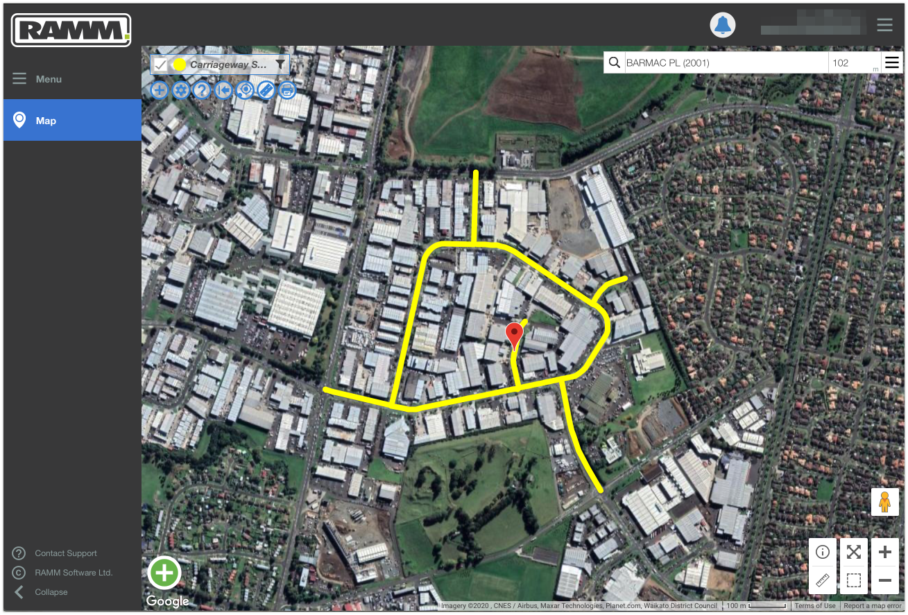
The centrelines were then loaded either as shapefiles or with the Python-created bulk import file. After this process, some quick calibration checks were done with the RAMM Centreline Manager toolset.
And thats it. Now all successfully loaded, these roads have created the foundations of the TalkData network.
As we are playing with a fictional network, whats in there now is just the starting point. There will no doubt be a few changes take place on the TalkData network over future blog posts!