The information tool you need to try in RAMM Map
Do any of these situations sound familiar?
You have been looking at a location in RAMM Map and wondering where exactly it is within your linear network? Perhaps the number of metres that location is from the road origin, or the offset from the centreline, or both?
You have tried using the map measuring tool to try and find out how far away a location is from the start of the road?
You have just wanted to know some basic details about whats going on somewhere on your network?
Great news; there is a simple tool that will help you in these type of situations; the Road Information tool.
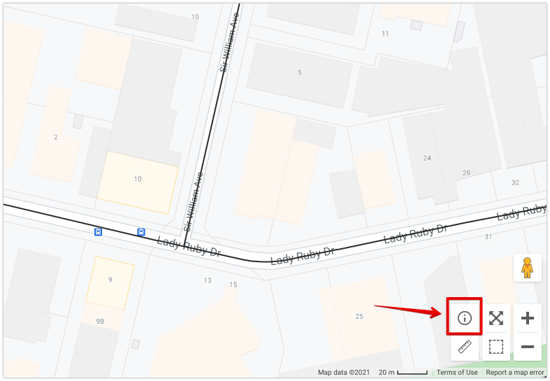
In the bottom right part of the RAMM map screen, you will see there are 6 tool icons available to you. Today we are focussing only on the Road Information tool (the 'i' in the circle).
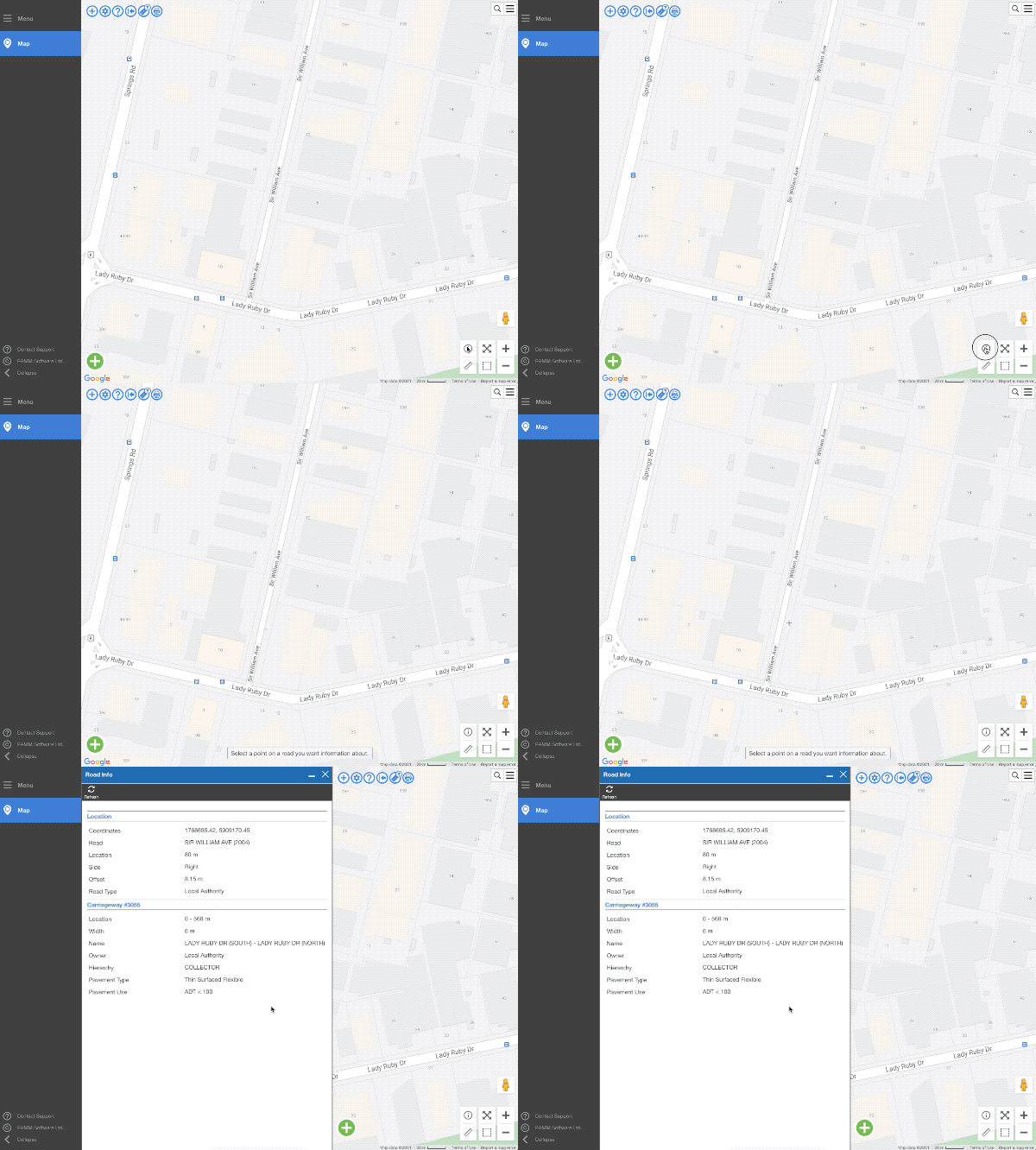
After you click on the road information tool icon, simply click again anywhere on the map. A window will open with information relevant to the specific point where you clicked.
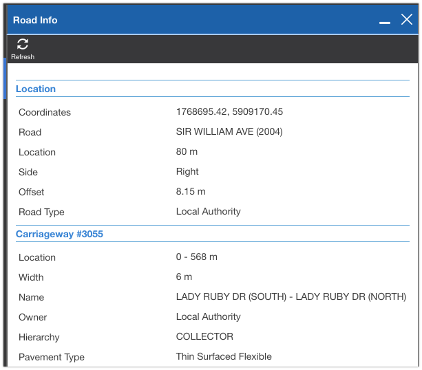
The information presented is really useful. Lets take a closer look at some of the information you will get...
From the screen above you can see that a single click will tell you all sorts of things about that point. Information like the relevant road, linear location, side, offset and coordinates.
Carriageway section are also shown, including widths, start and end names, hierarchy and pavement type.
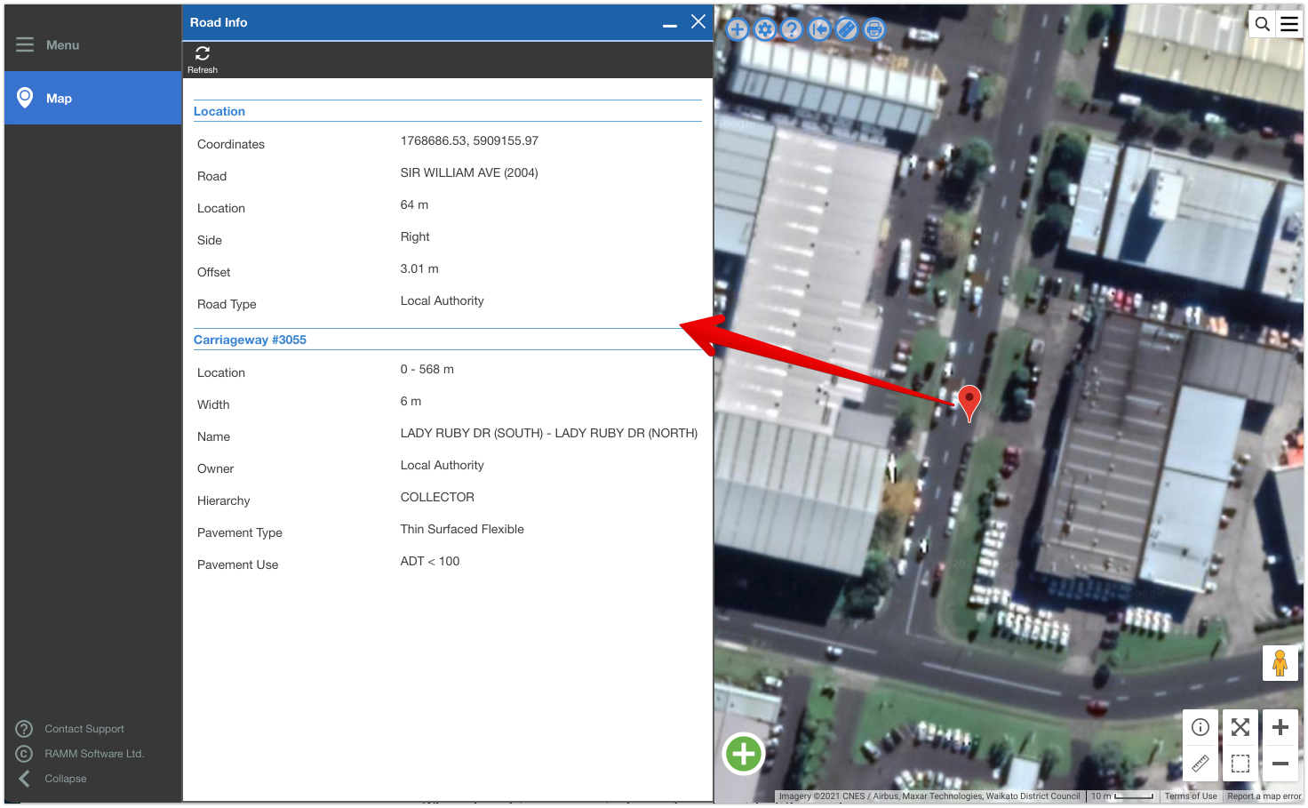
This the tool works when you are using different base maps. So that means you can can still use the tool when looking at the Satellite layer as well.
The information displayed is dependent on the what data is available in the database for the selected road.
What you can see in the screenshots in this post, is from the TalkData network. This network is being built progressively over time through this blog. So the amount of information displayed is less than you would typically find in a production environment.
If you were to try this on a real-world network, with a single click you could see information such as (example attributes included in brackets);
Location details (coordinates, road name and road_id, location, side, offset, road type etc.)
Carriageway details (carriageway ID, location, width, start and end names, ownership, One Network Road Classification (ONRC) category, hierarchy, pavement type, pavement use, service levels etc.)
Treatment lengths ( location and width)
Roughness (average NAASRA, minimum and maximum NAASRA, standard deviation and dates)
Traffic (ADT, VKT, heavy vehicle percentage)
Major surface details (material, dimensions, life and surface date)
Major Pavement (dimensions, life and layer date).
So from a single click on the map, you can rapidly get a wealth of information displayed. This is very useful to get some quick insights at any given point on your network.
Give it a try next time you are in RAMM Map!


